
Never imagined you could optimize trick-or-treating? Well think again– LandVision™™ makes it possible!
Want the biggest candy bars? The safest route? To fill that orange pumpkin-shaped bucket with as much candy as possible in the shortest amount of time? We’ve got you covered. This is trick-or-treating 2.0!
To begin, LandVision™™ is typically used by companies needing to make serious and impactful business decisions. For example, real estate brokers looking for profitable off-market opportunities, or builder-developers seeking the best plot of land for their next project. In honor of Halloween, however, we’d like to show you how the same existing datasets and workflows within LandVision™™ that streamline route optimization and right-of-way management could also revolutionize trick-or-treating.

Using LandVision™ to Plan an Optimal Route
This Halloween, we encourage you to take a break from using LandVision™™ to optimize your business operations, and instead to use it for the serious business of making the most out of the holiday. Use data to plan your route, and you’ll even be able to create a detailed map to print out or refer to right on your phone.
Here’s how LandVision™™ can help you achieve your trick-or-treating goals for the best Halloween ever:
Goal: Get the Best Candy
There’s a certain hierarchy when it comes to candy. Full-size Twix, Snickers, Kit Kat, Reese’s, and Hershey’s chocolate bars are at the top of the pyramid, followed closely by the snack-sized versions. Second-tier candy includes individually wrapped pieces of gum, small Tootsie Rolls, and of course, the dreaded box of raisins.
There’s no way of knowing for sure what anyone is going to hand out, but you can make the odds work in your favor by using property data gathered from LandVision™.
Crunch the numbers to identify the areas where there is a higher probability of getting pricier candy. Here’s some of the data you can pull to create a map of the homes most likely to be giving out treats rather than tricks:
– Household income
– Land values
Goal: Get the Most Candy
If quantity matters more than quality, all you need to do is look for the areas with a higher density of households. Your Halloween LandVision™™ map can be used to illustrate:
– Property density
– Apartment buildings
– Condo communities
– Retail centers (many retail centers hand out free candy on Halloween!)
Pro tip: Combine tactics 1 and 2 for the best of both worlds! Your LandVision™ map allows you to layer data, so you can easily generate a map of the optimal area that checks all the boxes.
Goal: The Safest Route for Trick-or-Treating
On a serious note, safety is obviously very important. Trick-or-treating takes place when it’s dark out and there are a lot of young children walking around. You also want to make sure you’re in a safe neighborhood and that there will be plenty of people around.
Safety is essential, and here’s the data LandVision™ provides to help you discover the safest possible route:
– Traffic counts
– Neighborhoods away from busy streets
– Crime rates
– Vacant land (you don’t want to find yourself in a deserted neighborhood!)
Goal: Finding the Fun Halloween Neighborhood
Part of the fun of Halloween is seeing other people’s costumes and hearing groups of children shout “Trick-or-Treat!” It’s just not the same trudging from house to house by yourself in a quiet, dark neighborhood.
The best Halloween neighborhoods are those with a lot of kids around. Here are some data points that can reveal where all the fun is happening:
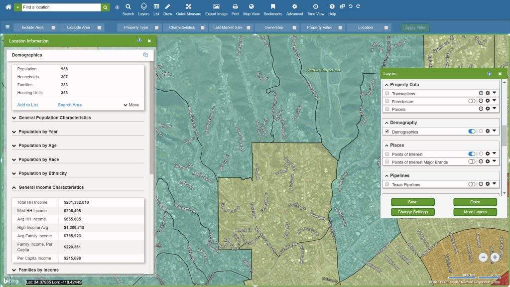
– Demographics – look for areas with a high density of families
– School district boundary maps
Happy Halloween!
By using the strategies outlined above, you’re sure to enjoy top-tier candy well into 2019. Don’t forget–you can layer multiple data points onto a map using LandVision™, so you can customize a map based on your family’s specific goals. Have fun, stay safe, and plan a route that will impress your friends and neighbors!
Of course, LandVision™™ is used for much more than planning optimal trick-or-treating routes. Our cloud-based mapping application helps commercial real estate brokers, builders, land developers, insurance companies, and more gain instant access to detailed, accurate property data and contextual surrounding data.
Click here to talk to a member of our team and learn how LandVision™™ can help make for a happy Halloween and a successful business!