Creating a rich, highly accurate national fabric of broadband coverage with over 300 property attributes & spatial data layers….
Learn moreLandVision℠
Comprehensive location mapping software, analysis & management for industries including commercial real estate & government sectors.
A map-based location intelligence application, LandVision serves all types of industries from commercial real estate to the government and public sectors. Powered by SpatialStream®, LandVision visualizes map-ready content.
Why choose LandVision℠
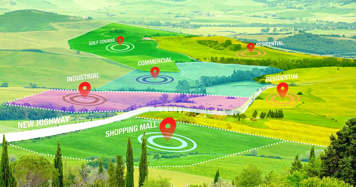
Find new investment properties
Join the 20,000+ real estate agents, investors, brokers and auctioneers who use LandVision to inform commercial & residential property investment decisions.
Analyze market potential
Access multiple GIS data elements for the most authoritative view on location and property details.
Gather comprehensive property ownership data
Gain in-depth parcel map insights, right down to property ownership details.
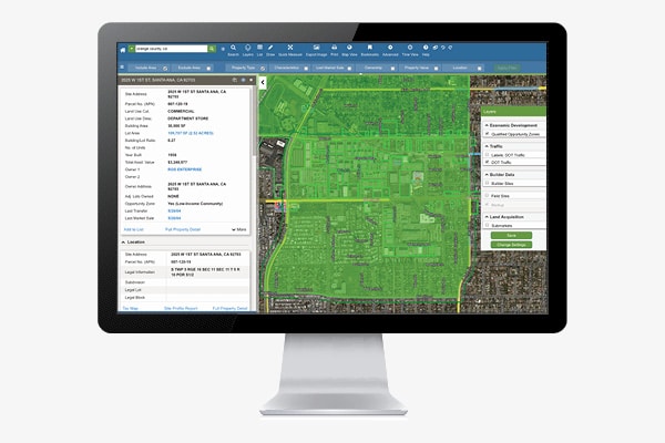
Find new properties
Search for properties that meet all of your most important criteria
- Use property characteristics such as ownership information, assessed value, lot size, land use, and building square footage to identify promising locations.
- Research the surrounding area using natural hazards, points of interest, and school attendance zone layers to find the properties that are most ideal for your needs.
Analyze your market
Utilize multiple data layers to conduct thorough market analysis
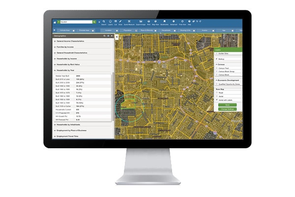
- Leverage demographics, points of interest, builder sites, and other additional datasets to understand the unique characteristics of your market.
- Import and overlay your own location data, or data you collect from third-party sources, to perform an in-depth analysis within a single, all-in-one CRE solution.
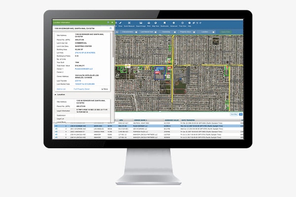
Manage your assets
Visualize your assets and service territories with ease
- Import the locations of your real estate holdings or infrastructure assets to better understand your existing portfolio.
- Easily send notifications or marketing mailers to property owners using our automatic mail merge functionality.
Present your findings
Generate property images and reports with a single click.
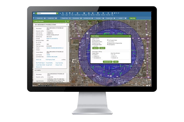
- Present properties to your clients or colleagues using five different types of aerial imagery.
- Create automated site profile reports complete with the most relevant property information and a thorough analysis of the surrounding trade area.
Customers we’ve empowered

“LightBox is an incredible timesaver. Now everything is in one place. Our marketing team can now do their work in half the time thanks to LandVision℠, and that means they can reach out to more prospects.”

Vice President of Marketing at Giroud Tree and Lawn
“Everything we do is property-related, and we get so much value from the data we gather from LandVision℠. I can’t imagine what businesses did before this type of technology solution was available.”

Anchor Loans
“A big benefit is that we can track the complete holdings of an individual and can see what other properties they own. Being able to see everything together shows me what owners might be willing to do with their portfolio.”

SVN/Walt Arnold Commercial Brokerage, Inc.
“We use LandVision℠ to better understand the market and identify micro-markets within. It enables us to drill into parcel level data that includes ownership information, zoning, date of last transaction, etc.”

CA Student Living
How LandVision is different
Powered by SpatialStream®, LandVision visualizes SmartParcels®, our nationwide parcel database that ties 300+ property and tax attributes to parcel boundaries, as well as our other map-ready content. LandVision is completely extensible, so when you’re ready to grow, LandVision grows with you.
Connected Data
Boundaries
Parcel Boundaries
Nationwide parcel boundaries with 300+ property and tax attributes to help you make more confident decisions. Covers 3,100+ U.S. counties including territories, with over 150 million parcels with polygon geometry that is completely normalized.
Boundaries
Building Footprints
Building footprints are geospatial boundaries that provide the outline of a building drawn along the exterior walls.
Property
Historical Tax Assessment
Official record of property from tax assessor from previous years.
Recommended Insights
Brokers
How CRE Brokers Leverage LandVision for Targeted Site Selection
Real-time data gives brokers a competitive edge in today’s uncertain commercial real estate (CRE) environment. As we reported with builder…
Data
The Changing Landscape of Data Center Zoning
As the exponential growth of digital businesses and AI continues to surge, the landscape of data centers is shifting. New…
Brokers

Q&A with PRISM Advisory Board Member Patrick Jacolenne
An Insider’s Look at the Evolving Landscape of Real Estate Data Interview with: PRISM Advisory Board Member, Patrick Jacolenne, Founder…
Have questions? Want a demo? Let’s chat.
Fill out the form below and a member of our Sales Team will contact you shortly.